FieldAlytics™: A Better-Than-Birds-Eye View
Jul 25, 2022

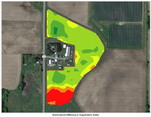
Federated’s field mapping software, FieldAlytics™, offers growers a better-than-birds-eye view of their fields. The software records field “reflectance” via satellite imagery as it passes over the earth in its orbit.
If there’s a strong crop growing, the imagery will show a strong reflectance (see photo). “The good areas and the bad areas will be evident in the field, from border to border,” said Kevin Carlson, Federated’s agronomy sales manager.
The field imagery reveals inconsistencies in the crops, and can provide a good indicator of yields. As the satellite record images week over week, it’s possible to see changes that could affect yields. When it comes to effective crop management, satellite imagery is “another tool we can use,” Carlson said.
The fields of growers who have used Federated’s spraying or spreading services have already been mapped by the satellites, and those images are available to view online. “Work with your Federated Agronomist to access and view the images,” said Carlson. They can help you interpret what you see.
FieldAlytics imagery is available once your borders, your Common Land Units (CLUs), have been identified. Federated makes those identifications for every field they enter for spraying or spreading. “If we service your fields,” said Carlson, “we have your field images.” Talk to us to learn more – and see how things look from the sky.